

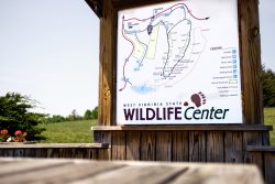
The Geographic Information Systems (GIS) and Technical Support Program is an office under the Wildlife Resources Section, Operations Unit. We integrate advanced mapping, geospatial technologies, data management, planning, and human dimensions and citizen science surveys in all units and programs within the Wildlife Resources Section.
DATA and REPORTS
GIS & Technical Support
– An overview of important Wildlife Resources data and maps.
– For spatial data downloads and ArcGIS Online public content.
Reports, StoryMaps and Surveys
– Interactive online reports and citizen science & hunter/angler surveys
Planning
HUNTING & FISHING MAPS
Interactive Hunting, Trapping & Fishing Map
– Now accessible on mobile devices (iPhone, iPad, Android, Windows) web browser. Learn how to use the Hunting and Fishing map here.
Wildlife Management Area Maps
– These maps are perfect for printing and viewing Wildlife Management Area maps with topographic background information.
Lake Fishing Maps
– These maps are perfect for printing and viewing lake maps with depth information. Watch the West Virginia wildlife lake mapping video here.
WV DNR Avenza Maps
– Download the Avenza Maps app on your mobile device to view and navigate on downloaded maps offline.
For additional information, please contact the GIS and Technical Support Program at:
DNRGIS@wv.gov
(304) 637-0245
Elkins Operations Center
PO Box 67
Elkins, WV 26241